
Geographic Time Travel
As a “popular historian” rather than a learned academic, I believe that part of my job is to explore some of the same sources that academics do, and then to bring them into today for the average person to explore with me. Case in point, historic maps.
David Rumsey Map Collection
Very early on an historian, Woody Holton, was gracious enough to have lunch with me to discuss my historical project. He shared numerous sources, including a gem of a website, the David Rumsey Map Historic Collection. It’s a digitized, catalogued historic collection, searchable by region, time period, mapmaker, and so much more. It was there I found late 18th century maps of Britain’s “Middle colonies”—what would become the middle United States. Some maps were so incredibly detailed and high-resolution that I could zoom into ferry landings where travelers would stop to cross on boats before bridges came into existence.
Making Historic Maps Relevant to Readers
While locating those ferry landings was like finding gold for a story in which a guy rides across the colonies in 1776, trying to write modern fiction around archaic maps—such that every day people now could recognize where my character might be—was like trying to dislodge that gold and contextually reposition it using a toothpick. It was tedious. I would pull up the historic map in one browser window, pull up Google maps in another, and flip between them. Or, that was what I had to do five years ago, before the collection added a new feature—the Georeferencer.
The Georeferencer Revolutionizes Map Exploration
The Georeferencer, now in version 4, according to the collection, “it allows you to overlay historic maps on modern maps or other historic maps. The overlaid maps reveal changes over time and enable map analysis and discovery.” Now, my 1776 map is set precisely over the Google map, among others, and moving a simple toggle bar allows me to fade from the old map to a current day one.
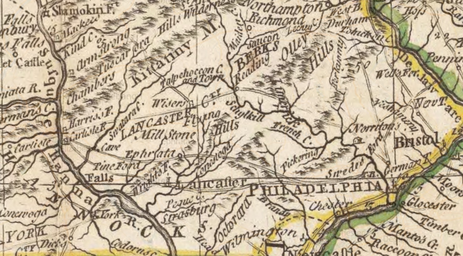
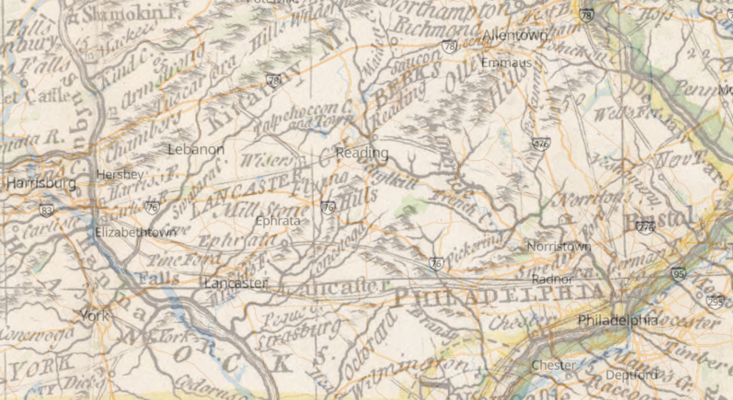
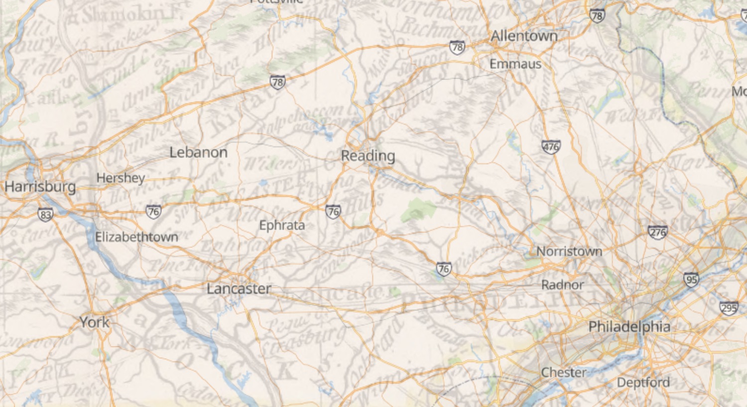
I’ve taken these three screen captures of a 1776 cross section of the land in Pennsylvania featured in my novel. Nathaniel ventures into the Kittatiny Mountains to the west, his homeland is along the Saucony Creek in the middle upper Berks County, and he travels first to Philadelphia in the bottom right. The first image below is the original map, the second shows the overlay, and the bottom image is the modern Google map.
You can pop open a new browser window and toggle the maps within the Georeferencer for the 1776 map shown above here.
Prepare to lose all track of time. Maps both of this whole wide world and those of the past are literally at your fingertips.
Reader Insider Note: I was so impressed by Rumsey’s map collection, and the changes that map-making has undergone since 1776, that it plays a small role in the novel for my protagonist. Nathaniel is often marking up old maps. It was during the early years of the Revolution that George Washington, among others, recognized the rebels were never going to win a war with antiquated maps made by the British. In 1777, Congress authorized a national geographic division to chart and draw the fledgling nation.
. . . . . . . . . . . . . . . . . . . . . . . . . . . . . .
For more history nerd posts like these, subscribe to the blog. Guest posts are welcomed and encouraged. Contact me for details.
For behind-the-scenes author-related news, giveaways, and to find out where I might be speaking near you, subscribe to my e-publication, CHASING HISTORIES.